
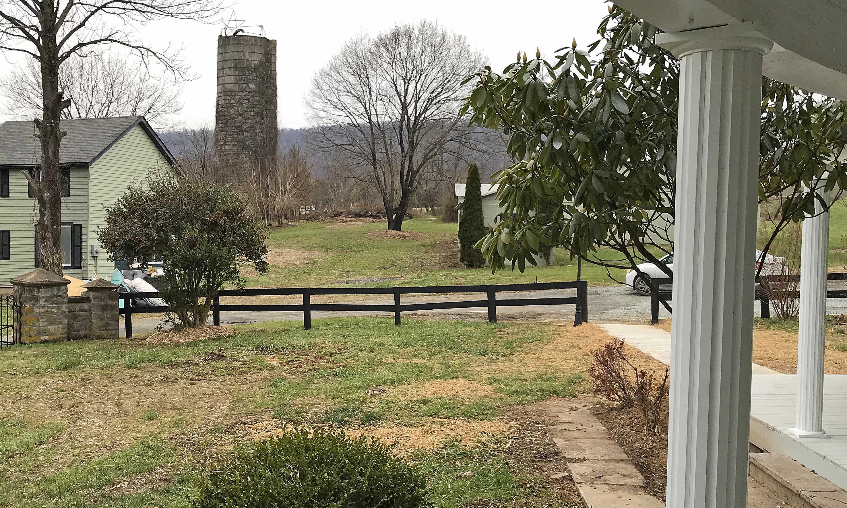
In this picture is a broadband source to connect to the Internet
Out in Western Loudoun, near Lovettsville, there are various ways to get on the Internet.
There is of course by satellite connected to a dish by your house.
There are broadcasting links atop various structures including a silo out by Stevens Road. What else would you expect in the country? It had to be on a silo.
Dishes are put outside home windows pointed toward the “broadcasting” structures including the devices affixed atop a silo.
You have to look long and hard to see the connecting devices including atop that old silo.
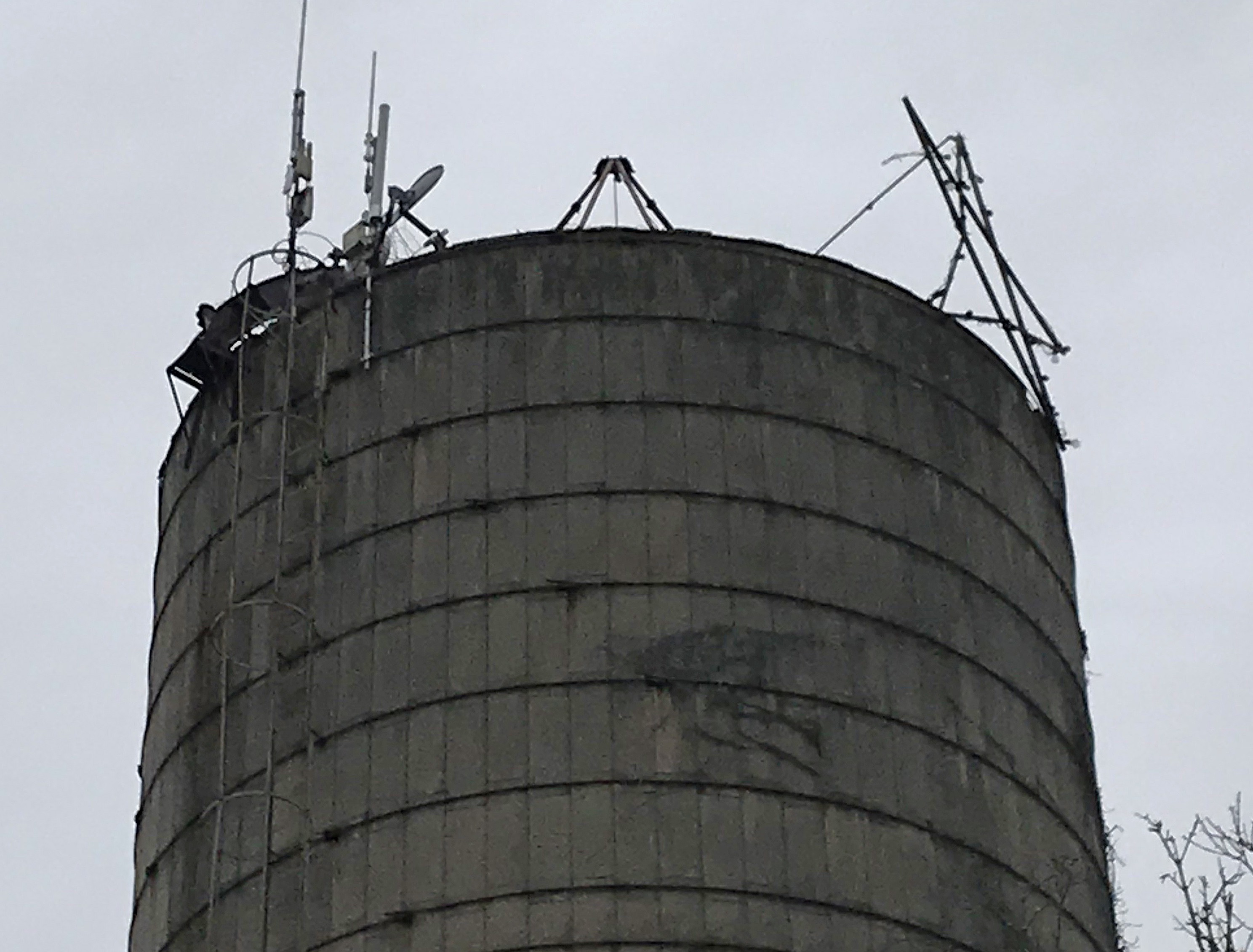
Connection to the Internet via silo
The County Board has promised it was going to make a difference to broad band in Western Loudoun.
But little or nothing has happened to do so.
Some were surprised by the recent pronouncements by Loudoun’s Economic Development folks that “Loudoun County Leads Virginia in Broadband Use.”
“According to the latest figures from the U.S. Census Bureau,” according to the County’s Economic Development Crew, “Loudoun has the highest percentage of households with a fixed broadband (not mobile) Internet subscription in Virginia.”
Unfortunately, this is “somewhat” off the mark as they are really only talking about eastern Loudoun.
There was a broadband survey that the County conducted earlier this year. It was in May and was extended through July 27, 2018 for residents to express their opinion.
There was an online map that showed the reaction.
Only “blue” was “great” and that was dominant in the eastern part of the County; “green” was “hit or miss” online (heavy in the West), and “red” was “terrible” (dominant in the West) and, as a result, the map of Western Loudoun looked like the onslaught of a teenage acne condition.
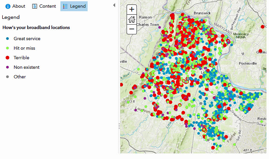
The survey map that was – and isn’t any longer
By the way, if you go looking for this map, as it appeared, and found in this article, it’s vanished; one source argued that’s what the County does to “hush” up what they don’t want the community to consider.
The original url was http://loudoungis.maps.arcgis.com/apps/webappviewer/index.html?id=1a995526e50c424896bfa48fdb793d9e .
When you go to that address (url) now, you will find a map and an array of only blue dots and no legend as to what the blue dots represent. Continue reading